A silent crisis unfolds beneath the vast farmlands of Northern Nigeria. While the region holds a significant portion of the country’s freshwater resources, a stark reality endangers its food security and economic stability: less than 3% of Nigeria’s total cropland is under irrigation. The rest depends on increasingly erratic rains, leaving millions of farmers and the national food supply chain perilously vulnerable. This is not merely an agricultural challenge; it is a foundational inefficiency where industrial-scale problems—water mismanagement, climate volatility, and resource waste—demand a systemic, intelligent response. The deployment of a scalable smart irrigation in northern Nigeria system represents a critical test case for applying precision technology to solve endemic resource crises.
The central question for analysts and policymakers is no longer if technology is needed, but which technological framework can deliver precision at scale. The emerging answer lies in the fusion of industrial-grade artificial intelligence with satellite remote sensing and ground-based sensor networks. This integrated approach moves beyond theory, offering a tangible pathway from reactive farming to predictive resource management. By analyzing the “why” behind this transformation, we see it as a critical case study in applying scalable AI to solve endemic resource crises, positioning Northern Nigeria not as a perpetual aid recipient, but as a frontier for sustainable agricultural innovation.
1. The Imperative for Change: Data Meets Dry Soil
The pressure to act is quantified by climate data and agricultural economics. The Nigerian Meteorological Agency (NiMet) predicts significant shifts for 2025, with delayed rainfall onset and an early end to the season expected across many northern and central states. This shortening of the growing window, coupled with high evaporation rates, creates a precise challenge for water management. The traditional response—expanding cropland by clearing forests—has proven counterproductive, degrading ecosystems without solving core yield inefficiencies.
Concurrently, the potential for improvement is immense. Research demonstrates that integrating satellite data with local sensor inputs can drastically improve water use accuracy. A study on estimating crop irrigation requirements found that calibrating satellite-derived evapotranspiration data with local models achieved a highly reliable correlation (R² up to 0.97) with actual field values. This means water needs can be predicted from space with remarkable precision. In practical terms, innovations in dry-season farming, such as advanced irrigation and drought-tolerant seeds, are already showing potential to increase rice yields by up to 40%. The foundational data and proof of concept exist; the task is systematic integration at an industrial scale.
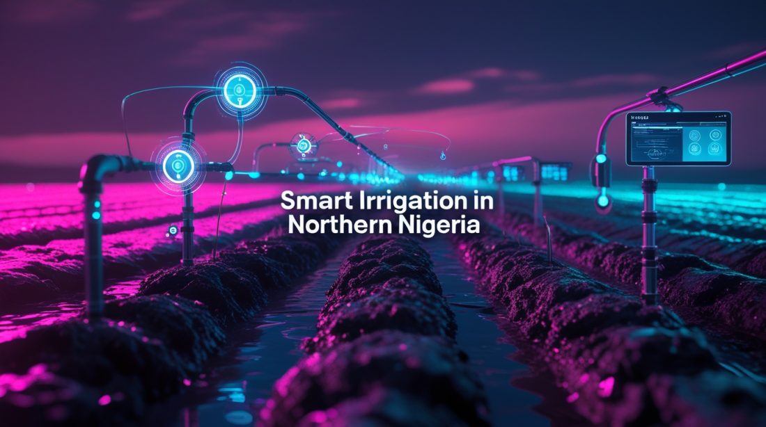
2. The Satellite-Sensor Fusion: A Two-Tiered Intelligence Network
The core of an effective smart irrigation in northern Nigeria system is a two-tiered data architecture that merges macro-scale visibility with micro-scale accuracy.
- The Orbital Perspective: Satellite Surveillance
Satellites like Sentinel and Landsat provide constant, wide-area monitoring. Key indices such as the Normalized Difference Vegetation Index (NDVI) and the Normalized Difference Water Index (NDWI) serve as the system’s vital signs. NDVI tracks crop health and biomass, while NDWI measures water content in soil and plants. For instance, in Nigerian maize fields, NDVI values typically peak between 0.55 and 0.75 during a healthy growing season, and a sudden drop can signal water stress or disease, triggering an alert. This allows for the management of thousands of hectares from a single dashboard, identifying problem zones invisible to the ground observer. - The Ground Truth: Sensor Networks and AI Analytics
Satellites tell the “what” and “where,” but in-field sensors explain the “why.” Soil moisture probes, weather stations, and IoT devices provide real-time, localized data on soil water tension, temperature, and humidity. This is where machine learning becomes pivotal. AI models, such as those reviewed for arid region water management, ingest this blended data stream—satellite imagery, sensor readings, historical weather, and soil maps—to forecast evapotranspiration rates and predict precise irrigation schedules down to the sub-field level. This prevents both under-watering and the massive waste from over-watering, which depletes aquifers and causes nutrient runoff.
3. From Data to Decisions: Practical Applications and Barriers
Translating this data fusion into action creates direct value. AI-powered advisory platforms can deliver hyper-localized instructions to farmers via SMS or basic smartphones, advising on optimal watering times and quantities. This is not a distant future concept. Companies like AgriSens Limited are already working to bring such generative AI-powered, data-driven solutions to rural communities in Northern Nigeria. Furthermore, satellite-enabled monitoring supports innovative financial tools, allowing lenders and insurers to verify crop health for loans or assess damage for claims, reducing risk and increasing capital access for smallholders.
The barriers, however, are significant and define the roadmap for implementation:
- Infrastructure & Cost: Deploying and maintaining sensor networks and ensuring stable internet/power connectivity in remote areas is a primary hurdle.
- Data Integration & Skills: Success requires merging disparate data sources (satellite, sensor, weather) and building local capacity to interpret and act on AI insights.
- Institutional Coordination: As highlighted by research from the University of Delaware, effective expansion requires breaking down silos between government agencies, research bodies, and farmers to align policy with technological capability.
4. The Human Impact and Future Outlook
The ultimate metric of this industrial AI application is human resilience. Consider the story of Ako Prince Omali, a farmer in Kogi State, whose livelihood is annually threatened by floods. For communities like his, AI-driven early warning systems are being used to trigger anticipatory cash transfers, allowing families to prepare before disaster strikes. This same predictive logic, applied to irrigation, can secure livelihoods against drought.
The future of smart irrigation in northern Nigeria hinges on moving from pilot projects to ecosystem-wide adoption. This demands a focus on collaborative governance, local capacity building, and sustainable business models that make the technology affordable and manageable. The goal is a transformed agricultural landscape: one where AI, satellites, and sensors orchestrate a efficient and responsive water management system. This turns vulnerability into resilience, ensuring that Nigeria’s agricultural heartland can not only feed its growing population but also serve as a blueprint for arid regions worldwide.
❓ FAQ: Smart Irrigation and AI in Northern Nigeria
What is smart irrigation and how does AI make it “smart”?
Smart irrigation uses data to apply the exact amount of water crops need at the right time. AI makes it intelligent by analyzing information from satellites (showing crop health and broad soil moisture) and ground sensors (giving precise local data) to predict daily water requirements and automate scheduling, minimizing waste and maximizing yield.
Can this technology work for smallholder farmers in remote areas?
What are the biggest benefits for farmers and the region?
Is there any real-world proof this works in Nigeria?
Absolutely. Organizations are already implementing related AI models for flood prediction and cash-based interventions. In agriculture, satellite data is already used to advise on maize and rice farming, and Nigerian agro-tech companies are actively developing and piloting AI-driven solutions for smallholder farmers.
What needs to happen for this to be adopted widely?
Widespread adoption requires collaboration. Government policy must support technology integration, the private sector needs to build affordable and durable solutions, and farmers require training. Building strong links between researchers, tech providers, and farming communities is essential to tailor tools to local needs.
Fast Facts
Northern Nigeria faces a critical water management crisis, with under 3% of farmland irrigated despite climate shifts. A practical solution exists: fusing satellite data (for wide-area monitoring) with ground sensors and AI analytics (for precise, hyper-local advice). This integrated smart irrigation in northern Nigeria system can drastically cut water waste, boost yields by 20-40%, and build farmer resilience. While challenges like infrastructure and training remain, ongoing local initiatives and AI-driven climate adaptation projects prove this transformative, industrial-scale approach is not just viable—it’s urgently needed.
Want to stay ahead of how intelligent technology is transforming foundational industries? Subscribe to our newsletter for monthly in-depth analysis on the practical application of AI in agriculture, water management, and beyond.
Further Reading & Related Insights
- Generative AI Systems at Art Basel → Explores how generative AI systems reshape creative markets, connecting to your theme of AI transforming foundational industries.
- AI Agent Automating Desktop Tasks → Examines how agentic AI moves from chat to direct action, relevant to scaling smart irrigation workflows.
- Computer Vision Quality Control for Nigerian Exports → Highlights AI’s role in enforcing reliability and compliance, echoing the precision and trust needed in irrigation systems.
- Robotics in Nigerian Factories: Downtime Reduction → Shows how robotics reduce inefficiency in Nigerian industry, aligning with your focus on AI reducing resource waste in agriculture.
- Managing Orphaned AI Models: Industrial Risk → Discusses governance and sustainability in AI adoption, complementing your emphasis on institutional coordination and long-term resilience.